
The cities of Winslow, Holbrook and Joseph City and the Four Corners region at large sit above one of the most complex groundwater systems in the American West, in a basin that has been running a water deficit for decades. Before the region can evaluate what it is any new development will demand of that system, it helps to understand what the system actually is, how it works and what the most current science says about its condition. This article is part of a two-part series from the Painted Desert Tribune on groundwater supply and how potential industrial development could impact that supply.
To understand what is at stake, it helps to start with the ground itself. An aquifer is a layer of permeable rock, typically sandstone or limestone, whose pores are saturated with water. When rain falls or snow melts on surrounding mountains and high plateaus, some of that water seeps into the ground rather than running off. It travels slowly downward and sideways through rock formations, sometimes moving only inches per year, until it reaches the saturated zone that makes up the aquifer. Water enters the system through a process called “recharge.” It leaves through natural discharge at springs and stream channels, through lateral movement into adjacent basins and through wells. When withdrawals exceed recharge over time, the water table drops. If it drops far enough, wells that were drilled to a certain depth stop producing water even if water remains deeper in the formation.
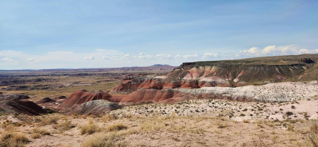
The principal aquifer serving the communities is part of what geologists and water managers call the C aquifer system, which includes the Coconino Sandstone and several associated rock formations. The Coconino Sandstone is a tan to white, cross-bedded quartz sandstone created by sustained pressure on ancient sand dunes and it is the primary water-bearing unit for much of northeastern Arizona. Near Winslow, the Coconino Sandstone is approximately 800 feet thick. The aquifer extends well beyond Navajo County, reaching into northwestern New Mexico, southwestern Colorado and southeastern Utah and it underlies the entirety of the Hopi Reservation and most of the Navajo Nation.
The water in this aquifer is not uniform in quality. A 2025 report by the U.S. Geological Survey, prepared in cooperation with the Hopi Tribe, analyzed groundwater chemistry data from 117 sites in the Coconino aquifer collected between 1933 and 2008, with most sites concentrated in the corridor between Flagstaff and Holbrook. Total dissolved solids, a measure of minerals and salts dissolved in water and commonly referred to as TDS, ranged from 199 milligrams per liter to 10,400 milligrams per liter across the sampled sites, with a median of 755 milligrams per liter. The U.S. Environmental Protection Agency’s secondary standard for TDS in drinking water, which is a taste and quality benchmark rather than a strict health limit, is 500 milligrams per liter. Approximately 73% of sampled Coconino aquifer sites in the study area exceeded that standard.
The reason for the elevated dissolved solids is geological. Beneath roughly 3,500 square miles of the southeastern portion of the study area, including the area around and east of Holbrook, lies a buried deposit of halite, which is rock salt. As groundwater flows northward through the aquifer, following the natural tilt of the rock formations, it contacts this salt body and dissolves sodium and chloride, producing water with the chemical profile of sodium-chloride brine in much of the area. The USGS report found that 42% of sampled sites had a sodium-chloride water type, with the highest concentrations south of Holbrook and in a broad zone north of Winslow. The highest TDS value in the entire dataset, 10,400 milligrams per liter, came from an 800-foot well in the Coconino Sandstone located south of Holbrook. This salt-influenced chemistry is why the Hopi Tribe’s municipal well at the Village of Moenkopi, north of the main study area, required reverse osmosis treatment before the water could be used for drinking.
The Arizona Department of Water Resources, known as ADWR, is required by state statute to prepare Supply and Demand Reports for each of Arizona’s 51 groundwater basins. The 2025 assessment for the Little Colorado River Plateau Basin was completed in November 2025 and provides the most current comprehensive picture of the region’s water balance. The basin covers 26,700 square miles in northeastern Arizona. It has an estimated population of 272,231 people, and approximately 63.9% of its area lies within federally recognized Tribal lands belonging to the Navajo Nation, the Hopi Tribe, the Pueblo of Zuni, the White Mountain Apache and the San Juan Southern Paiute. The Joseph City Irrigation Non-Expansion Area, established in 1980 under the Groundwater Management Act, also lies within the basin boundaries.
The water budget for the basin works much like a checking account. Supplies are deposits: surface water flowing in rivers and streams, groundwater recharge from precipitation, treated wastewater available for reuse and small amounts of water moved from other basins through the C.C. Cragin Pipeline. Demands are withdrawals: water consumed by agriculture, municipal users, industry and the natural environment from trees to slugs around the water corridors. The difference between deposits and withdrawals each year either adds to or subtracts from groundwater storage, which is the account balance. In northeastern Arizona, that account has been in the red for decades.
Total average annual supply across all sources was estimated at approximately 84,166 acre-feet in 2024. One acre-foot is approximately 325,851 gallons, enough to supply roughly two average Arizona households for a year. Mountain-front recharge, the process by which snowmelt and precipitation infiltrate the rock at higher elevations and slowly enter the aquifer, averages approximately 280,071 acre-feet per year and is the largest single input to the groundwater system. Offsetting that, natural groundwater outflow from the basin through subsurface pathways averages approximately 210,400 acre-feet per year, a substantial figure reflecting the regional flow of groundwater northward and out of the basin.
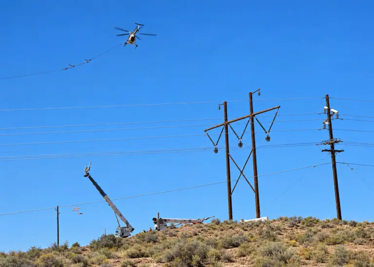
Total water demand in the basin in 2024 was estimated at approximately 165,939 acre-feet. The gap between supply and demand was roughly 81,774 acre-feet. In practical terms, the basin withdrew approximately twice as much water as it received in 2024, and that imbalance has persisted throughout the entire period for which ADWR has data. The deficit reached nearly three times supply in the early 1990s, and the gap has narrowed primarily because major industrial water users closed rather than because supply increased. The Navajo Generating Station, which had been the basin’s single largest industrial water user, closed in 2019. The Kayenta and Black Mesa mines operated by Peabody Energy closed in 2019 and 2005 respectively. As well as the closure of the Cholla Power Plant in 2025. Those closures released significant industrial demand that had previously been drawing down the aquifer.
The consequence of this long-running imbalance is measurable. Groundwater storage in the basin was estimated at approximately 74 million acre-feet in 1990 and had declined to approximately 70 million acre-feet by 2024, a reduction of about 4 million acre-feet over 34 years. The ADWR calculates storage not to the maximum depth of the aquifer but to the average depth of existing wells in the basin, which is 387 feet. That methodological choice reflects a practical reality: a well installed at 387 feet produces no water once the water table drops below that depth, regardless of how much water may exist deeper in the formation. The average recorded water level in basin wells is currently 260 feet, leaving approximately 127 feet of buffer. If water levels were to drop to the average well depth of 387 feet, the ADWR estimates that approximately 61% of existing wells in the basin would run dry.
The ADWR’s supply and demand projections extend through 2075 under five distinct scenarios, each modeling different assumptions about population growth, climate, conservation practices and technological change. Under the Status Quo scenario, in which current conditions are essentially held constant, the annual supply-demand deficit remains at approximately 116,607 acre-feet per year and groundwater storage declines from approximately 79.6 million acre-feet in 2025 to approximately 77.4 million acre-feet in 2075. That is a continued but relatively gradual drawdown, roughly 2.2 million acre-feet over 50 years, under current demand patterns.
Climate change is projected to worsen the situation across all scenarios. The assessment modeled temperature increases of 1 degree Fahrenheit, 5 degrees Fahrenheit and 10 degrees Fahrenheit above baseline, corresponding to low, medium and high greenhouse gas emissions pathways for Arizona. Under the high emissions scenario, agricultural irrigation demand is projected to grow by approximately 19% by 2075, and the water consumed by natural vegetation along rivers and streams is projected to increase by roughly 8% as higher temperatures drive more evaporation. Even under the low emissions scenario, irrigation needs are estimated to grow by about 2%.
Agriculture, which saw its water use drop sharply from more than 35,000 acre-feet per year in the early 1990s to less than 10,000 acre-feet in the 2000s and 2010s, has been climbing back. By 2024, agricultural demand had returned to approximately 20,485 acre-feet per year. Remote sensing data showed an increasing trend in agricultural consumptive use in the basin from 2016 to 2023. If that trend continues through 2075, the ADWR estimates irrigation withdrawals could increase by 62%, with the agency noting that sufficient land exists in the basin to support that level of expansion.
On the positive side, conservation and technology improvements can meaningfully reduce demand. If efficiency requirements similar to those in Arizona’s regulated Active Management Areas were applied to this basin, residential water demand could decline by 17% by 2075. Technology adoption, including advanced metering, leak detection and irrigation system upgrades, could reduce agricultural withdrawals by approximately 9% and household consumption by roughly 13%. Population in the basin is also projected to decline modestly under current demographic forecasts, which would reduce municipal demand by approximately 16% by 2075, though population projections carry inherent uncertainty.
Layered over the physical picture is an unresolved legal one. The Navajo Nation, the Hopi Tribe and the San Juan Southern Paiute Tribe each have claims pending in the Little Colorado River General Stream Adjudication, a court proceeding to formally establish water rights across the river system. In 2024, the Northern Arizona Indian Water Rights Settlement Agreement was executed. Once authorized by Congress and made legally enforceable, it would resolve all existing water claims by those three tribes within Arizona. That authorization had not occurred as of the date of this article. The relationship between any new industrial water permits and the eventual terms of the settlement is not yet formally defined.
None of the ADWR’s five projection scenarios incorporates the water demand of gigawatt-scale industrial development, because no such development was considered when the assessment was prepared. That is where the second part of this series begins.
Two large development proposals, one near Winslow and one near Holbrook, have bene moving through the planning process. Both are large scale industrial developments. Both involve data centers, a category of industrial user whose water needs vary by several orders of magnitude depending on cooling technology and design choices. What those proposals are, what they have committed to in the public record and what questions remain unanswered will be the subject of the next article in this series.